MIAMI – The 2026 Atlantic hurricane season is approaching October without producing a single hurricane, an extraordinary contrast with the Pacific, where powerful hurricanes have developed in rapid succession. The unusual pattern is largely being driven by a strong El Niño, which is suppressing tropical development on one side of Central America while creating more favorable conditions on the other.
The Atlantic had produced seven named tropical storms through the weekend, but none reached hurricane strength. National Hurricane Center data showed accumulated cyclone energy, or ACE, of only 8.9 through September 26 — about 90 percent below the 1991-2020 normal for this point in the season.
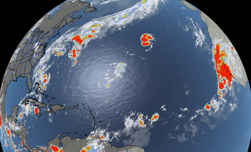
The situation is particularly remarkable because September is normally near the heart of the Atlantic hurricane season.
The absence of hurricanes this late in the year has not occurred since 1914, according to meteorologists tracking the season. By September 21, six tropical storms had formed without any becoming a hurricane, already establishing the unusual historical milestone.
The Atlantic has since produced additional tropical activity without breaking the hurricane drought.
El Niño suppressing Atlantic hurricanes
One of the main explanations is the strong El Niño currently influencing global weather patterns.
El Niño develops when waters in the tropical Pacific become unusually warm, altering atmospheric circulation far beyond the Pacific itself.
NOAA had already anticipated an unusually quiet Atlantic season earlier this year. Its preseason forecast gave a 55 percent probability of below-normal activity, primarily because El Niño was expected to strengthen during the hurricane season.
For Atlantic hurricanes, one of the most important consequences is increased vertical wind shear.
Wind shear occurs when winds change speed or direction at different levels of the atmosphere. Tropical cyclones require relatively organized thunderstorms around their center. Strong shear can displace those thunderstorms and prevent a developing system from establishing the vertically aligned circulation needed to intensify.
NOAA says El Niño typically increases this disruptive wind shear across the Atlantic, making it more difficult for tropical storms to organize and strengthen into hurricanes.
Dry air and Saharan dust have also periodically made the environment less favorable for development this season.
Pacific tells completely different story
On the Pacific side, the situation could hardly be more different.
The eastern Pacific had already generated 16 named storms, six hurricanes and four major hurricanes by September 26. Its ACE stood at 148.3, about 68 percent above normal.
Activity across the wider eastern and central Pacific has been even more striking, with multiple powerful systems developing during September.
Among the most spectacular was Hurricane Polo.
Polo intensified into an extremely powerful Category 5 hurricane last week, reaching sustained winds of 285 kilometers per hour. At one point, the National Hurricane Center measured its minimum central pressure at around 900 millibars.
The hurricane subsequently weakened but remained dangerous as it approached Baja California Sur in Mexico on Monday. Authorities prepared for destructive winds, flooding and storm surge as the system approached land.
The contrast between the two basins demonstrates the powerful influence El Niño can have on tropical weather. The atmospheric conditions that inhibit Atlantic hurricanes can simultaneously favor development over the Pacific.
Curaçao should not consider season over
For Curaçao and the wider Caribbean, however, the extraordinary lack of Atlantic hurricanes does not mean the threat has disappeared.
The official Atlantic hurricane season continues through November 30.
Historically, tropical cyclones can still form during October and November, particularly in the Caribbean Sea, where ocean temperatures remain sufficiently warm late in the season.
NOAA's preseason outlook, despite favoring a below-normal season, still projected between eight and 14 named storms and three to six hurricanes for the full season.
The Atlantic therefore still has time to produce its first hurricane of 2026.
The season is also continuing to generate tropical storms. On Monday, Tropical Storm Hanna formed in the central subtropical Atlantic with maximum sustained winds of approximately 75 kilometers per hour. It was far from land and was not expected to pose a threat to coastal areas.
That makes Hanna the eighth named storm of the Atlantic season, meaning the total has already changed from the seven recorded through the weekend.
What remains unchanged is the statistic that makes 2026 exceptional: as September draws to a close, the Atlantic still has not produced a hurricane.
For Curaçao, that is welcome news — but with two months remaining in the official season, it is still too early to declare the island and the Caribbean completely in the clear.